This post may contain Amazon affiliate links which means, as an Amazon Associate, I may receive a small commission from purchases made through these links at no cost to you. I only recommend products I have personally used. To learn more, please see my privacy policy page.
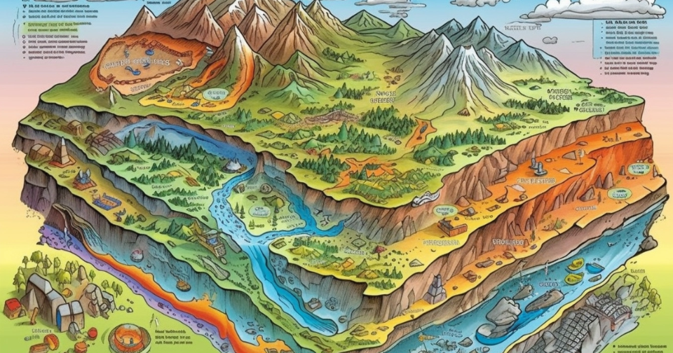
Geomorphology is the study of landforms and the processes that shape the Earth’s surface. Through erosion, sediment transport, and tectonic activities, our planet’s diverse landscapes are continually evolving.
Key Words
- deposition
- erosion
- fluvial
- geography
- GIS
- GPS
- landforms
- landscape
- physical geography
- remote sensing
- scientific method
- sediment
- tectonics
This article examines these geomorphic processes, their significant role in environmental dynamics, and the impact of climate change as well as human actions. Read on…
Key Takeaways
- Geomorphology, concerned with the study of Earth’s landforms and their evolution, assesses how geomorphic processes such as erosion, weathering, deposition, and tectonics shape landscapes, providing insights into past, present, and future terrain transformations.
- The field of geomorphology evolved from early observations and theories, like Davis’s geographical cycle of erosion, to modern quantitative and technological approaches, integrating tools such as remote sensing, GIS, and GPS for advanced terrain analysis and modeling.
- Interdisciplinary connections in geomorphology extend its relevance beyond scientific study to practical applications, including environmental engineering and resource management, enhancing our capability to manage natural hazards and support sustainable development.
Exploring Geomorphology
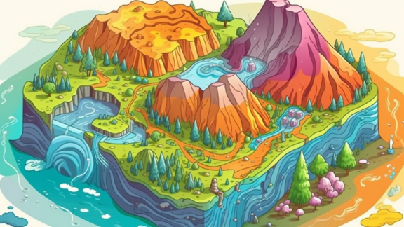
Geomorphology is an intriguing field of geoscience that studies landforms and their evolution. This study sheds light on the complex processes involved in shaping the Earth’s surface, such as erosion, weathering, deposition, transport and tectonic activities.
The interplay between these forces results in a variety of landforms found on our planet. These processes are responsible for forming physical features visible across different landscapes.
Understanding how landscapes came to be provides valuable insight into their history and dynamics. By examining terrain changes over time, we can anticipate future alterations with greater knowledge about its formation.
The Role of Climate Change in Geomorphology
The issue of climate change has become a top priority as its impact on geomorphological processes is significant. This renewed focus on climatic geomorphology stems primarily from concerns about how global warming affects Earth’s landscapes. The changing global climate brings about various consequences for these geological processes, such as alterations in precipitation patterns and temperature regimes, influences on river discharge rates, and changes in the frequency and intensity of extreme weather events.
One major result of this shifting climate is an accelerated melting of glaciers, which directly contributes to increased sediment load in rivers. As a result, there are heightened risks for flooding and significant geological transformations within landscapes. To effectively forecast and manage future landscape changes related to glacial geology – closely connected with these climatically driven morphological modifications – it is crucial to understand them fully.
Comprehending the impacts that varying climates have on geomorphological processes has important implications for our understanding of not only environmental shifts but also their effects.
Fluvial Geomorphology: Rivers and Streams
Fluvial geomorphology is the study of rivers and streams, focusing on how they shape the land through interactions between water, sediment, and channel boundaries. These processes involve various forms such as bed load transport and suspended material or dissolved load movement to create features like floodplains, meanders, and braided streams.
A key element in fluvial geomorphology is the drainage basin, which includes a main river and its tributaries. Regular surveys of these basins are important for identifying significant geological characteristics, including those found in sedimentary basins. Comprehending dynamics at confluences where two rivers meet along with understanding impacts from tributaries play crucial roles in studying functions within fluvial river networks.
Historical Development of Geomorphology
The origins of geomorphology can be traced back to early thinkers such as Aristotle and Shen Kuo. In the 19th century, there was a notable increase in interest in this field of science, which laid the foundation for its modern development.
One pivotal moment in geomorphology came when William Morris Davis proposed his geographical cycle of erosion model during the 20th century. This marked a significant advancement and led to an understanding that landform development is complex and contingent upon various factors. Today’s discipline of geomorphology incorporates quantitative approaches like fluid dynamics, solid mechanics, laboratory studies, and theoretical work along with techniques such as landscape evolution modeling.
With advancements in technology like remote sensing, GIS, and GPS, the analysis process of terrain has become integral to studying landscapes via geomorphic principles. As science continues to grow, the evolution of new theories and methods allow us to closely examine the mechanisms shaping our Earth’s surface. This emphasizes how crucial it is to not only appreciate, but also understand, the nature and the intricacies behind landscape evolution within geography as well as any scientific field that relates to existing knowledge on these topics.
From Davis's Model to Contemporary Understanding
In the late 1800s, William Morris Davis introduced his groundbreaking theory of the ‘geographical cycle’, which served as a foundation for modern geomorphology. This model outlined stages of erosion and development including uplift, river valley carving, maturation into wider valleys, flattening into a peneplain and rejuvenation with new uplift. While it did not account for all processes such as mountain formation erosion, Davis’s concept remains significant in understanding stream evolution.
There has been a shift towards process geomorphology over time within this field of study. With an emphasis on measuring rates of operation and responses to different forms of development like land formations or coastal changes through more extensive measurements than before, it marks it as distinct from past eras’ approach furthering our knowledge about geological mechanisms.
This shift towards employing holistic examination methods marks significant progress in understanding the underlying factors of geomorphology. It has paved the way for modern research in this field, opening up extensive possibilities to grasp environmental changes. This approach highlights crucial details and fosters evidence-based understanding, moving beyond mere assumptions. As a result, we now have access to more nuanced and plausible explanations.

Interdisciplinary Connections in Geomorphology
The beauty of geomorphology lies in its ability to surpass boundaries and establish connections with a variety of disciplines, providing a holistic understanding of Earth’s physical geography. This includes the recognition of past events’ impact on landscapes as well as the widespread implementation of geomorphic principles in areas such as geology, geodesy, engineering geology, archaeology, climatology, and geotechnical engineering.
This interdisciplinary approach extends significantly into quaternary geological studies. Demonstrating an extensive reach that encompasses diverse fields within both physical geography and related scientific domains.
Geomorphology and Environmental Engineering
The practical significance of geomorphology also extends to its applications in environmental engineering. The manipulation and spread of grazing animals, as well as agricultural practices, are examples of human activities that have resulted in significant changes to geomorphic processes such as soil compaction, increased runoff, gullying and erosion along streambanks.
The intensive methods of corporate agriculture, in particular, cast a stark light on the adverse effects of human activities on geomorphological processes. This form of agriculture often involves large-scale land alteration, excessive water usage, and heavy reliance on chemical inputs, leading to soil degradation, erosion, and contamination of water bodies. Such practices exacerbate the vulnerability of ecosystems, particularly in arid regions where the balance of natural resources is already precarious. Understanding these impacts is crucial for developing and implementing geomorphologically informed strategies in environmental management. These strategies aim not only to curb the negative effects of corporate agriculture but also to promote sustainable practices that harmonize with the natural dynamics of our landscapes.
Having a comprehensive understanding of desert geomorphology is crucial for effectively managing scarce resources and mitigating natural hazards. This highlights the importance of incorporating insights from geomorphology into decision-making processes for sustainable development initiatives aimed at preserving our environment.

Geomorphic Processes and Earth Materials
Geomorphology deals with the interaction between processes and materials in shaping landscapes. The diverse range of geomorphic processes involve applying mechanical stresses to earth materials, including rock, soil, and ice. This leads to strain and results in changes to the landscape such as glacial movements, volcanic activity, wind erosion, and weathering by rain.
Understanding these complex geomorphic processes is crucial for comprehending how various landforms are formed over time. Surface processes driven by water flow, gusts of air, wave action from glaciers, natural forces like wind, rainfall, and changing conditions through periodic stiving forces affect chemical reactions that contribute to forming soils. Earth’s surface also undergoes transformation due to this mixture, which ultimately leads to diverse patterns on Earth, such as sand deposits.
Mass Movement and Its Impact on Landscapes
Mass movement, a type of geomorphic process, has a significant impact on shaping landscapes. This includes natural occurrences such as landslides, rockfalls, debris flows, and lahars. These events alter the steep slopes of land and lead to changes in topography. Each occurrence leaves its own unique mark on the landscape, which can affect ecosystems and habitats.
The rate at which mass movement processes occur is influenced by both biological factors like burrowing animals and tree growth/decay as well as steeper slopes created over time. Understanding these processes plays an important role in predicting potential risks associated with them and managing landscapes effectively.
Having knowledge about mass movements is critical in understanding dangers that they pose to people living near or traveling through areas where they frequently happen while also considering aspects of their influence on nearby vegetation species including habitat structures around sloping terrains thus aiding efforts aimed at effective management of fragile environments.
The Global Tapestry of Landforms
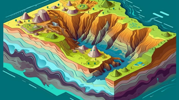
The earth’s surface is a vast canvas of topographic features. Land surfaces are each unique in their formation due to various geomorphological processes. These landforms include the towering peaks of the Himalayas, expansive plains of the Serengeti and the rugged coastline along the Great Ocean Road.
These distinctive landforms have been shaped by diverse processes such as aeolian (wind), coastal erosion, glacial movements, tectonic forces, and volcanic activity. Whether it be through wind or water currents carving out canyons like the Grand Canyon or glaciers shaping mountain ranges like the Alps – these geologic events continue to shape our planet’s terrain with remarkable results.
Landform Distribution and Dynamics
The distribution and movement of landforms are not random, as they are greatly influenced by tectonic processes. These processes are heavily impacted by the composition of the underlying bedrock. Conversely, surface phenomena such as water, wind, ice, wildfires, and biological activity interact with geological forces like uplift and subsidence to form and shape various landscapes.
This complex interplay between different types of processes is responsible for creating the diverse array of landforms that can be seen worldwide today. Each individual feature, whether it’s a towering mountain or a peaceful river valley, tells its own unique story about how it came into being and changed over time through evolution.
Ultimately, a delicate balance between surface events and tectonic actions gives rise to these distinct formations on our planet. As we continue to study them, this helps us gain insight into their formation, dynamics, evolution, and ongoing transformation under Earth’s ever-changing conditions. Among all of this, surface features play an important role in sculpting terrain and shaping our environment.
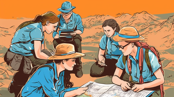
Geomorphology in Practice: Case Studies
We can gain a true understanding of the impact of geomorphology by examining real-life cases. The study of desert landscapes, for example, offers fascinating observations into the behavior and evolution of dry regions in our world.
Applying Geomorphology to Other Planets
The field of geomorphology encompasses more than just our planet. Planetary scientists use examples from Earth to interpret the development of landforms on other celestial bodies, comparing familiar features to those found on planets like Mars. The study of Martian geomorphological processes has revealed intriguing formations such as features created as gullies and polygonal ground, which provide valuable clues about the Red Planet’s past climate.
The abundance of impact craters across different planets is a useful tool in understanding their geological history, both here on Earth and elsewhere in our solar system. By closely examining specific landforms such as barchan dunes on Mars, we can enhance our knowledge about wind patterns and sediment movements, thereby expanding our comprehension of these fundamental processes that shape landscapes not only on Mars but also here at home.
Wrap Up...
The dynamic and constantly evolving nature of our planet is revealed through the journey across its diverse landscapes, shaped by powerful geomorphological processes. The study of these processes includes not only understanding their impacts on climate and landscape change, but also exploring the historical development in this field. It involves interdisciplinary connections and practical applications in environmental engineering to comprehend how landforms are formed. As we continue to delve into this fascinating world of geomorphology, one thing becomes clear, it provides valuable insights for our understanding of a variety of terrains on Earth.
Frequently Asked Questions
What is the study of geomorphology?
Geomorphology is the examination process geomorphology of earth’s surface and its formation through various processes, including tectonic activities, erosion, and weathering. This field delves into understanding both the past and present characteristics of landforms on our planet.
What is geomorphology in simple words?
Geomorphology is the examination of landform traits, origin, creation, and progression. It encompasses a combination of descriptive observation and numerical assessment to understand how Earth’s surface has been shaped through various natural forces over time.
What is an example of geomorphology?
Geomorphological processes encompass a variety of natural phenomena such as erosion on riverbanks and lakeshores, changes in land and ice cover, geological events like mountain uplifts, and investigations into how waterways shape landforms – for instance, the creation of the renowned Grand Canyon.
These are just some examples showcasing geomorphology’s impact on shaping our planet. It encompasses numerous activities involving various elements including rivers and streams that have a significant influence on altering landscapes through time.
What are the 4 processes of geomorphology?
There are four exogenic geomorphic processes that play a vital role in shaping the earth’s surface: weathering, mass wasting, erosion, and deposition. These processes are essential for understanding how the Earth’s surface is formed. Weathering and erosion contribute to altering the landscape through breaking down rocks and transporting sediments while mass wasting refers to gravity-induced movements of rock or soil on slopes. Deposition involves depositing these transported.
How does climate change impact geomorphology?
Climate change impacts geomorphology by altering precipitation patterns and temperature regimes, ultimately affecting river discharge rates and the frequency of extreme weather events. This has significant consequences for landscape evolution and landform development.

